Unlock the potential of your land with Digital Mapping services! Whether you need 2 acres or 20 acres mapped, our drone technology ensures precise, high-resolution imagery. By flying a simple grid pattern, we capture every detail, providing you with accurate maps tailored to your needs. Ideal for agriculture, land development, environmental surveys, or any project requiring detailed aerial insights.
A Simple Guide to Obtaining Quality Digital Maps
Mapping your property with precision has never been easier, thanks to advancements in drone technology. We will walk you through the process of obtaining high-quality digital maps, ensuring you have all the information needed for efficient planning and decision-making.
Step 1: Client Consultation
The first step in the mapping process is a consultation with you. Understanding the specific area to be mapped is crucial. During this discussion, we’ll identify the goals of the mapping project and any particular features that you wish to highlight. This ensures that the final product meets your expectations.
Step 2: Designing the Waypoint Mission
Once we have the necessary details, we can design a waypoint mission. This involves creating the most efficient and effective flight plan for our drone. The mission design takes into account factors such as altitude, overlap, and coverage area, which are essential for capturing high-quality imagery.
Step 3: Scheduling the Flight
After the mission plan is finalised, the next step is to select a suitable day for the drone operations. Weather conditions play a significant role in drone flights, so we’ll aim for a day with minimal wind to ensure optimal performance.
Step 4: Conducting the Flight
With everything in place, we’ll conduct the drone flight. During this phase, our team monitors the operation to ensure all images are captured as planned. Once the flight is complete, we review the captured imagery to confirm it meets our quality standards.
Step 5: Processing the Imagery
Once we are satisfied with the results, we move on to processing the imagery. This step involves creating a high-resolution 2D orthomosaic digital map, which combines multiple images into one cohesive map. This final product is invaluable for property planning and analysis.
Step 6: Client Review and Invoicing
Finally, we provide you with a preview of the map for review. Feedback is important at this stage, as we want to ensure that the final product aligns with your needs. Upon acceptance, you will receive an invoice for your very own digital map.
By following these steps, we make the process of obtaining quality digital maps straightforward and efficient. Whether you’re looking to enhance your property management or simply need accurate land data, our mapping services are here to help.
Choosing the right application to utilise your map is entirely up to you. We will recommend an Android/iOS app that’s excellent for maximising the potential of your digital map. This app requires only a GPS signal, making it ideal for areas where internet connectivity may be unreliable, such as rural locations.
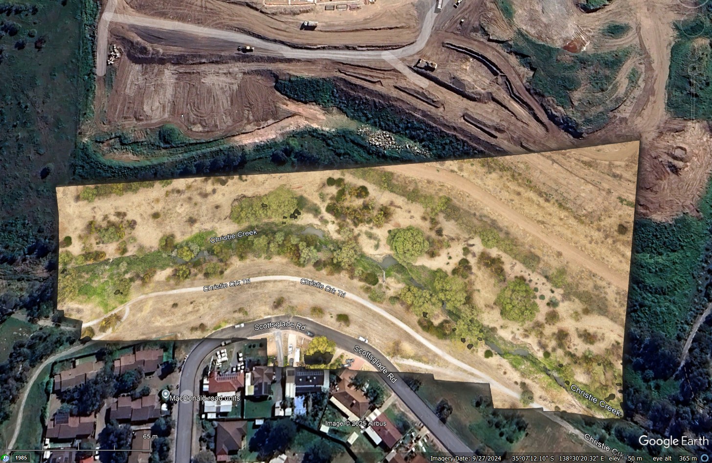
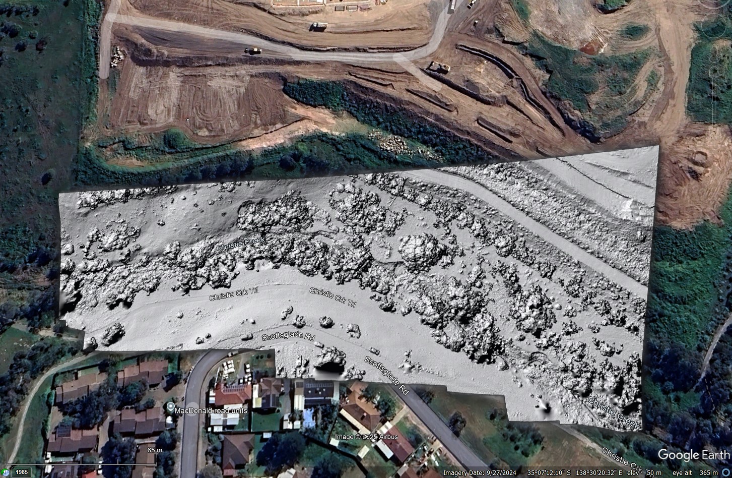
Additionally, your digital map can be accessed through the desktop version of Google Earth Pro. This allows you to overlay the digital map over existing maps and take advantage of the many features available in the application.
Use the slider bar in the image below to switch between the two digital maps (RGB 2D Orthomosaic and Digital Surface Model) that can be displayed using the image overlay feature in Google Earth Pro.
Pricing
While creating these larger 2D Orthomosaic maps requires a greater number of aerial images, we ensure that our pricing remains highly competitive. Our commitment to affordability means you get exceptional value for money without compromising on quality. Elevate your projects with stunning, high-resolution maps that provide the insights you need. Choose us for reliable, cost-effective mapping solutions that exceed expectations!
Mapping of areas larger than 20 acre are price on application.
*Extra costs may incur to cover the cost of extra travel